How can we improve the future of EO object detection?
At its core, EOImageNET addresses some of the most pressing issues in the field: data limitations, geographical gaps and model accuracy. The project seeks to create a comprehensive database that spans a wide range of geographical regions, object categories and image resolutions. This database is set to fuel the development of highly accurate detection models capable of operating across different environmental contexts – from tropical forests to dry desert climates – using optical satellite data, such as Sentinel-2 imagery. 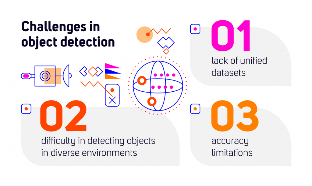
The ultimate goal of EOImageNET is to overcome the limitations of existing datasets and provide a unified platform that supports the development of object detection models that can work seamlessly across various Earth Observation datasets and satellite missions.
The Challenge of Building a Global EO Object Detection Model
One of the main hurdles in EO object detection is the lack of a unified, comprehensive dataset that covers the variety of object categories needed for accurate model training. Right now, current databases are often limited in terms of geographical coverage, resolution and object categories. For example, many EO databases lack key object categories such as buildings, vehicles and natural features like trees, or they may have limited geographical representation, making it difficult to build universal models.
Moreover, the accuracy of these datasets is often compromised by machine learning predictions that are not manually validated. That leads to potential errors in detecting certain object types, especially in areas with challenging environmental conditions. EOImageNET tackles these issues by consolidating data from multiple sources, ensuring the inclusion of a diverse range of objects, regions and seasonal conditions, which together form a truly global and multi-scale dataset.
How will EOImageNET advance object detection?
The EOImageNET project is redefining object detection in Earth Observation (EO) by improving data accuracy, scalability and practical applications. Here’s how it stands out:
Bringing EO Data Together
EOImageNET integrates satellite data from multiple sources, creating a diverse and high-quality dataset. By combining different EO databases, it ensures broad coverage of objects and environments, enhancing machine learning model performance.
Multi-Scale Object Detection
Satellite imagery varies in resolution, which poses challenges for traditional detection models. EOImageNET addresses this by offering multi-scale data, allowing models to adapt effectively to different image types and resolutions.
Precision Through Expert Labeling
Reliable object detection requires high-quality training data. EOImageNET prioritizes accuracy by using high credibility data samples, ensuring precision through meticulous annotation and validation.
Real-World Applications
EOImageNET is designed for practical impact across various industries. From tracking vehicles in airports and monitoring pipelines to detecting deforestation and environmental changes, the project enhances decision-making with more precise EO data.
Collaboration for Innovation
Developed as part of a contract with the European Space Agency (ESA) and in active collaboration with ESA, EOImageNET leverages expertise in EO data processing and artificial intelligence. This collaboration drives advancements in satellite-based object detection, pushing the boundaries of what’s possible.
EOImageNET is not just a dataset – it is shaping the future of EO object detection and its applications worldwide.
Cooperation for innovation
EOImageNET uses advanced AI, specifically convolutional neural networks (CNNs), to improve object detection in satellite images. These networks are trained on a diverse dataset. That allows them to accurately recognize objects at different image resolutions. By refining advanced models , the project enhances detection performance. 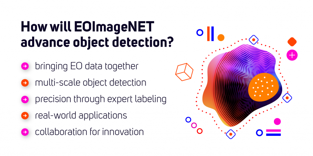
Additionally, EOImageNET explores new techniques like Scale-MAE, which helps the AI understand how objects are represented at different scales, making the model even more reliable and precise.
Leveraging the Power of Artificial Intelligence
EOImageNET is transforming how we use satellite data to understand our planet. By combining global coverage, high-quality data, and cutting-edge AI, it sets new standards for object detection in Earth Observation.
TUATARA is a key contributor. We bring expertise in space data analysis and AI-driven solutions to enhance the project’s scalability and precision. By applying advanced algorithms from our own EO initiatives, we ensure a robust dataset adaptable to diverse missions. Our experience in automated monitoring and prediction helps optimize models for large-scale image datasets. We support real-world applications like infrastructure and environmental monitoring.
As the project evolves, it paves the way for new applications in satellite analytics. It makes EO data more precise, accessible, and valuable than ever.